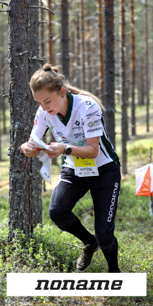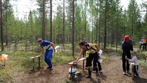
Photo: Orienteers punching the final control point of the Kainuu O Week 2012 in Joutenlampi
The Competition Centre of next summer's Kainuu Orienteering Week is located in the middle of one of Finland's most extensive moor terrain areas that have been transferred to orienteering maps. Another feature of the Joutenlampi area is the fast-moving terrain with lots of depressions and ridges. There are also lots of differences in altitudes - the deepest slopes and steepest ridge slopes should be taken into account when making route choices. The crystal-clear ponds and bright pine forests that break out in the middle of the terrain leave their mark on the natural beauty of the competition area. Further away, for planning the longest and more demanding tracks, there are some denser and more challenging terrain to offer.
The mostly fast-moving terrain, combined with the challenging orienteering tasks, makes the Joutenlampi a one of the most favorite race venues. We can say that Joutenlampi is a dream terrain for an orienteer, and it also enables the suitable course setting of all ages and levels, whether it's about elite orienteers or beginners.
Upcoming Kainuu O Week 2024 terrain has now been mapped. The map maker Pasi Jokelainen from the Mapline Oy has been mapping the terrain of his hometown a few years time. Next spring there will be only some minor updates and changes to be made on the maps.
Jokelainen has been doing thought and footwork in the forests of Joutenlampi, which have become familiar to him, for years before the latest map project. In fact, Joutenlampi has become a kind of professional "life's work" for Jokelainen: he prepared the first map version of the area already in 2002 for the Finnish Orienteering Championship.
Over the years, the map of Joutenlampi has not only been updated, but also developed, for example, with the possibilities of new technologies. For the first time, GPS coordinates have been added to the fully updated map of next year's Kainuu O Week, and the contours have been refined to become even more accurate with the help of modern laser scanning.
Despite the advanced information technology tools, the most important part of the mapper's work is still and will continue to be the raw physical walking (and mapping) around the map done by the mapper. During the years 2022-2023, Jokelainen has quite precisely walked 1,000 kilometers while working on next summer's 18 square kilometer map area.
"Exercising work and, at best, very comfortable in such good terrain," says Pasi Jokelainen about his mapping kilometers done by walking.
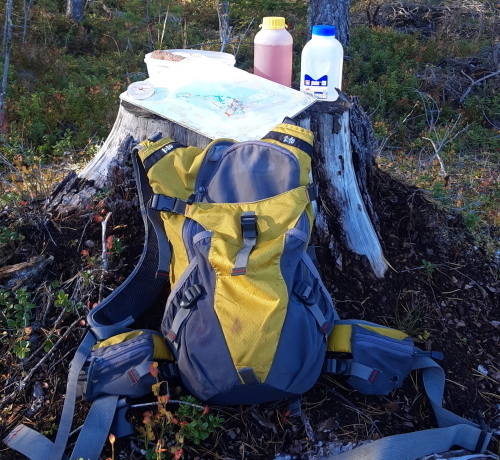
Photo: Kainuu O Week 2024 mapper’s lunch break in the forest
"Now the map is starting to be ready, during next winter and spring we will mainly check out the possible changes to the terrain and update the map if necessary", he continues.
Which map features would the mapper highlight that best describe the terrain of the coming summer?
According to Jokelainen, the depressions or contours tell the most about the terrain of Joutenlampi.
"A very characteristic place in Joutenlampi is a depression which is open at the bottom and where the deepest part of the depression grows open lichen or even grass. Yellow color on the bottom of depression as a map feature. There are a lot of those in the Joutenlampi terrain."
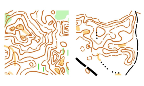
Photo: Depressions (with yellow open area) and curvy contours are typical for Joutenlampi terrain
The Competition Centre at the Joutenlampi is located in the middle of race terrains, so that there is a new terrain and map available for each day. Comfortable, fast and challenging (with its small features), there is enough to orienteer for the whole week. The scale of the maps will be 1:10 000, and in the older categories, 1:7 500, which makes map reading easier.