Hiking Routes in Hossa
Published: 26.03.2026
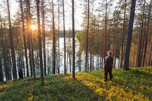
Ridge landscape in Hossa (Photo: Suomussalmen kunta)
Kainuu offers a wide variety of options for hiking and outdoor activities. This article provides an overview of the hiking routes in Hossa. A separate introduction to the trails in the Suomussalmi area was published on March 20, 2026.
Are you planning to go hiking during the rest days of the Kainuu Orienteering Week? The Suomussalmi and Hossa regions boast magnificent hiking trails featuring diverse terrain and breathtaking landscapes. Some routes are accessible for people with reduced mobility, and equipment rental for assistive devices is available in Vuokatti. In this bulletin, you will find the hiking routes in the Hossa area and their descriptions. More information and trail maps can be found via the links at the end of this article.
Hakokosken Hujaus Trail
- Route length: 5 km
- Distance from Suomussalmi center: 100 km
- Description: This route offers hikers stunning landscapes with ancient trees and silvery snags (standing dead pines). The trail is mostly easy to navigate, with the exception of a few steep climbs. The path circles Lake Syvä-Hoilua and leads hikers to Hakoharju ridge, the Hakokoski rapids, and Torkonluikea. It also connects to other trails, such as Huosiuksen huikonen trail and the Laukkujärvi trail.
Hossa-Martinselkonen Trail
- Route length: 57 km
- Distance from Suomussalmi center: 65 km
- Description: This route is part of the Eastern Border Summer Hiking Trail, a wilderness trek running along Finland's eastern border. The trail can be divided into sections lasting a day or two and can be completed in full or in part. Access points are located at the intersections of the hiking trail and the side roads branching toward the border from Hossantie/Juntusrannantie (Road 843). With excellent hiking infrastructure, it is well-suited for a 2–3 day trek.
Huosilampi Accessible Trail
- Route length: 1,3 km
- Distance from Suomussalmi center: 100 km
- Description: Located near the services of the Visitor Centre, Huosilampi offers something for everyone. Fishing is possible from accessible piers, and the area is surrounded by beautiful mire nature and campfire sites. The stunning scenery and lakeshore are easily reachable for those with strollers or wheelchairs.
Huosiuksen Huikonen Trail
- Route length: 8 km km
- Distance from Suomussalmi center: 100 km
- Description: An 8 km circular route that is mostly flat and easy to walk, except for some more demanding ridge sections. The overall scenery, with its elevation changes and water features, is breathtakingly beautiful. A large part of this trail also serves as the "Harjujen huikonen" mountain biking route. You can start the trail from the Visitor Centre and join the route via a nature path.
Kokalmus round trail
- Route length: 14 km
- Distance from Suomussalmi center: 72 km
- Description: On the Kokalmus loop, you can admire crystal-clear lakes throughout almost the entire journey. The Muikkupuro stream and its lean-to shelter—often considered the "gem of Hossa"—are located along this path. Hikers and mountain bikers share this 14 km circular trail. The route is easy and mostly flat, allowing you to focus on enjoying Hossa’s magnificent nature. The section leading to Muikkupuro is fully accessible.
Laukkujärvi Trail
- Route length: 10 km
- Distance from Suomussalmi center: 72 km
- Description: This 10 km loop starts near the Hossalaislammet parking area. The route follows the shores of Lake Talasjärvi and Lake Puukkojärvi. While mostly easy, the trail includes a few challenging steep descents and a ridge section with significant elevation changes toward the end. The loop can be extended by starting from the Huosivirta parking area and combining it with the 5 km Hakokosken Hujaus trail.
Lihapyöre Accessible Trail
- Route length: approx. 400 m
- Distance from Suomussalmi center: 90 km
- Description: Located by the Somerjoki River, this accessible route is crowned by beautiful river landscapes. The trail is clear and easy to navigate, surfaced with stone dust. It is suitable for electric mobility aids, such as electric wheelchairs or scooters. There is also an accessible platform for fishing.
Hossa Nature Trail
- Route length: 3 km trail network
- Distance from Suomussalmi center: 100 km
- Description: If you want to experience Hossa’s nature on a shorter walk, this 3 km loop around Huosilampi is the perfect choice. Information boards along the way tell stories of Hossa’s history and its diverse ecosystem. About half a kilometer of the trail is suitable for wheelchairs and strollers.
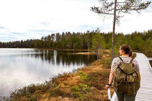
Hossa nature trail hiker (Photo: Suomussalmen kunta)
Muikkupuron mutka (Accessible Route)
- Route length: 1,5 km / one way (3 km total)
- Distance from Suomussalmi center: 72 km
- Description: The Muikkupuro lean-to is one of Hossa’s most iconic spots—a flowing stream situated between two crystal-clear lakes. The shallow, sandy-bottomed stream is perfect for wading. The trail is 1–1.5 m wide and surfaced with stone dust. There are some gentle inclines and declines; however, a steep descent at the end requires an assistant for wheelchair users. There is a sandy beach on the Keski-Valkeainen side for swimming, though the beach itself is not fully accessible due to a small embankment.
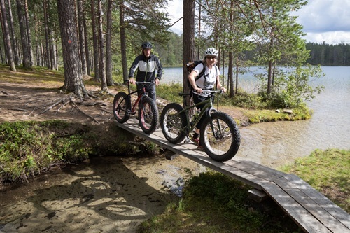
Mountain bikers on the Muikkupuro (Photo: Suomussalmen kunta)
Värikallion kaarros trail
- Route length: 7,3 km
- Distance from Suomussalmi center: 90 km
- Description: Hossa National Park is home to Finland's northernmost Stone Age rock paintings, estimated to be 3,500–4,500 years old. The trail leads to Lake Somerjärvi, where a walkway and viewing platform allow you to examine the paintings from just a few meters away. The route is classified as intermediate to demanding.
The Crossing of Ölökky
- Route length: 5 km
- Distance from Suomussalmi center: 104 km
- Description: This 5 km route follows the southern part of the Julma-Ölkky canyon and crosses the lake via a suspension bridge. Access to the bridge involves stone steps, and the opposite bank is reached via a rocky slope and metal spiral stairs. The trail starts from the Julma-Ölkky kiosk (to the left when facing the lake).
Ölökyn ähkäsy - Julma Ölkky Trail
- Route length: 10 km
- Distance from Suomussalmi center: 104 km
- Description: Julma-Ölkky is Finland’s largest canyon lake. The 10 km "Ölökyn Ähkäsy" trail runs along the top of its cliffs through forest and mire. The Ölökynperä lean-to is located at the northern end. The terrain is challenging at the start, with steep and rocky sections. The middle part is flatter, and the return journey on the other side of the lake is easier to navigate.
Further information and trail maps
Explore the routes, maps, and accessibility services in more detail via the following links:
- https://visitsuomussalmi.fi/en/trails-and-nature-attractions/
- https://visitsuomussalmi.fi/en/suomussalmi-trails/
- https://visitsuomussalmi.fi/en/hossa-trails/
- https://www.outdooractive.fi/fi/retkeily-ja-vaellusreitit/suomussalmi/retkeily-ja-vaellus-suomussalmella/127003816/ (only Finnish)
- https://www.outdooractive.fi/fi/offer/vuokatti-sotkamo/para-apuvaelinetoiminta-apuvaelinevuokraus-vuokatti/801582349/#dmdtab=oax-tab1 (only Finnish)
- https://vuokattisport.fi/solia-apuvalinetoiminta-vuokraamo/ (only Finnish)
Head out into nature and enjoy the spectacular trails of Suomussalmi!